


More Than Just Land Clearing: The Blueprint for Sustainable Forestry Land Preparation
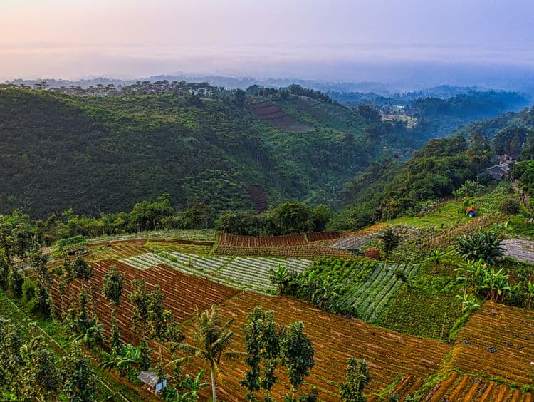
Land preparation in industrial forestry has clear guidelines and boundaries. Learn how long-term forest utilization plans, annual working plans, and conservation areas are mapped from the outset.
When hearing the term "land clearing," many imagine heavy machinery leveling forests indiscriminately. However, in sustainable forestry operations, land preparation is actually the most heavily regulated stage because every square inch of the working area is mapped and approved by the government in advance.
As an illustration, PT Mayawana Persada manages a working area of 136,710 hectares in Ketapang and North Kayong Regencies, West Kalimantan, based on official forest utilization business licensing. This legal framework serves as the umbrella for all land preparation activities carried out by the company, ranging from initial planning to field execution.
Legal Foundation: Working Plans as Operational Guidelines
Every operational activity, including the opening of work areas, is not driven by unilateral decisions. Everything refers to the long-term Forest Utilization Business Plan (Rencana Kerja Usaha Pemanfaatan Hutan - RKUPH) and the Annual Working Plan (Rencana Kerja Tahunan - RKTPH), both of which are approved by the government. These documents act as official guidelines regulating the location, scale, and schedule of each land preparation phase prior to planting.
In other words, no area is opened outside of the officially sanctioned working plans. This approach ensures that the entire process is traceable and accountable, rather than merely supported by empty claims.
Concession & Conservation Zoning Map: Separating Protected and Cultivation Areas
Before land is prepared for planting, the company conducts Concession Area Zoning (Penataan Areal Kerja - PAK)—a mapping process that separates protected areas from cultivation zones. Out of the total 136,710 Ha concession, approximately 25.16% (34,399 Ha) is designated as Protected Areas, consisting of Protected Forests, buffer zones, river riparian strips, germplasm conservation areas, wildlife protection areas, and peat ecosystem protection functions.
The remaining 74.84% (102,311 Ha) serves as Cultivation Areas, encompassing planted forests, community partnerships, and supporting infrastructure. This means work area expansion occurs exclusively within designated production zones, while protected areas preserve their ecological functions right from the planning stage.
High Conservation Value Areas: Studies Dating Back to 2015
Alongside zoning processes, the company identifies High Conservation Value (Kawasan Bernilai Konservasi Tinggi - KBKT) areas based on studies conducted since 2015 by the independent consultant Ecositrop. These assessments identified a total of 41,279 Ha of HCV areas specifically exempted from any land clearing or cultivation activities.
This designation demonstrates that decisions regarding restricted and unrestricted areas are made through independent third-party scientific evaluations. Consequently, land preparation runs parallel to long-standing conservation commitments.
Work Area Opening: Infrastructure for Efficiency, Not an Ultimate Goal
Work area opening typically involves constructing roads, canals, and supporting structures. This infrastructure is built to facilitate efficient planting, maintenance, and production activities, rather than serving as an end in itself.
Roads and canals streamline the mobilization of seeds, equipment, and harvests while supporting drainage systems within planting blocks. Through meticulous planning, infrastructure development is strictly contained within boundaries defined in annual plans.
Zero-Burning Land Clearing Policy
A core policy enforced since the land preparation stage is the strict prohibition of land clearing via burning. This zero-burning policy forms part of the company's commitment to supporting wildfire prevention, recognizing that fire risks in peat and mineral soils can cause widespread damage if unchecked.
What legal basis governs land preparation in industrial forestry concessions?
Through this policy, all clearing and site preparation are executed mechanically and systematically, minimizing fire hazards from the very beginning of the production cycle.
Part of an Integrated System: Micro Planning Plantation (MPP)
Land preparation in industrial forestry does not stand alone; it integrates into a broader framework known as Micro Planning Plantation (MPP) or the One Go System. This system unites land preparation, nursery management, planting, and maintenance into a continuous, scheduled workflow.
Through this approach, every prepared block transitions immediately into planting without unnecessary delays, preserving production rotations and operational efficiency.
Transparent Land Preparation, Beyond Unilateral Claims
Industrial forestry land preparation is a structured process. From legal frameworks and zoning separations to independent HCV mapping and zero-burning rules, all operations remain fully traceable through official documentation.
Through this measurable approach, PT Mayawana Persada ensures that raw material production—producing high-quality, legally verified raw materials within government-designated land boundaries—aligns seamlessly with ecological preservation and community needs around the concession.
FAQ
What legal basis governs land preparation in industrial forestry concessions?
Land preparation is governed by formal government-approved plans, specifically the long-term RKUPH and the annual RKTPH, ensuring every step follows established legal boundaries.
How are protected areas separated from production zones within the concession?
Through Concession Area Zoning (Penataan Areal Kerja), protected areas—such as peat protection functions, riparian zones, and wildlife protection areas—are segregated from cultivation zones prior to any operational activity.
How are High Conservation Value (HCV) areas protected?
HCV areas totaling 41,279 Ha were mapped through studies conducted by independent consultants (Ecositrop) starting in 2015, ensuring they are permanently excluded from development.
Does industrial forestry land preparation allow slash-and-burn methods?
No, a strict zero-burning policy is enforced, mandating fully mechanized land preparation to prevent fire risks from the outset of the production cycle.
Read also
 Environment & Biodiversity
Menyemai Mutu, Menggerakkan Ekonomi: Peran Sentral Nursery Modern PT Mayawana Persada
Read more Environment & Biodiversity
How is Sustainable Forest Management Implemented? A Comprehensive Guide
Read more.jpg&w=3840&q=75) Environment & Biodiversity
Environment & BiodiversityHow is Environmental Sustainability Measured in Timber Plantations? Key Indicators Explained
Read more